Project Outsourcing
Outsource your project to the MR CFD simulation engineering team. Our experts are ready to carry out every CFD project in all related engineering fields. Our services include industrial and academic purposes, considering the ANSYS Fluent software's wide range of CFD simulations. By outsourcing your project, you can benefit from MR CFD's primary services, including Consultation, Training, and CFD Simulation. The project freelancing procedure is as follows:
An official contract will be set based on your project description and details.
As we start your project, you will have access to our Portal to track its progress.
You will receive the project's resource files after you confirm the final report.
Finally, you will receive a comprehensive training video and technical support.
What is Urban Planning Engineering?
Early in the 20th century, the profession of modern urban planning evolved partly in response to the terrible social, sanitary, and economic conditions of the constantly growing industrial towns. Initially, architecture and civil engineering fields served as the core of interested experts. As the difficulties of managing cities became better understood, they were joined by public health, economics, sociology, law, and geography experts. The modern survey, analysis, design, and implementation procedures for urban and regional planning emerged from an interdisciplinary synthesis of these professions.
Urban planning nowadays can be characterized as a technical and political process concerned with people’s well-being, land use management, urban environment creation, networks of transportation and communication, and preservation and improvement of the natural environment.
To accomplish strategic, policy, and sustainability goals, urban planners collaborate with professionals in the related professions of civil engineering, landscape architecture, architecture, and public administration. Although urban planning is now a separate, independent professional discipline, early urban planners were frequently members of these related fields. Urban planning is a vast area that encompasses several related disciplines, including zoning, economic development, environmental planning, and transportation planning. A detailed comprehension of the zonal planning codes and criminal codes is necessary to create the plans.
Urban planning projects span small-scale interventions and renovations of existing structures, buildings, and public spaces to large-scale master planning of vacant sites or Greenfield projects.
Urban Planning Engineering is a field of engineering that focuses on the design and development of cities, towns, and other urban areas. It involves the application of engineering principles, along with social, economic, and environmental considerations, to create sustainable and livable communities. Urban Planning Engineers work to create urban spaces that are functional, safe, and aesthetically pleasing while also meeting the needs of the people who live and work in those areas.
Some of the critical areas of focus in Urban Planning Engineering include:
– Land use planning: This involves determining the best land use in urban areas, such as residential, commercial, or industrial.
– Transportation planning: This involves designing transportation systems, such as roads, highways, and public transit, that are safe, efficient, and accessible.
– Environmental planning: This involves considering the impact of urban development on the natural environment and developing strategies to minimize negative impacts and promote sustainability.
– Infrastructure planning: This involves designing and managing the infrastructure systems that support urban areas, such as water supply, wastewater treatment, and energy distribution.
Overall, Urban Planning Engineering is a multidisciplinary field that requires a broad range of skills and knowledge, including engineering principles, urban design, social and economic considerations, and environmental sustainability. Urban Planning Engineers play a critical role in creating livable and sustainable urban environments that meet the needs of current and future generations.
How can CFD simulation be applied in Urban Planning Engineering Industries?
To comprehend wind flow patterns in the built environment, computational fluid dynamics (CFD) has traditionally been employed in architecture, urban design, and urban planning. Its examination is crucial to determine whether a site’s natural ventilation is sufficient to reduce heat and pollutants for improved human comfort in crowded urban situations.
However, because of the complex operational needs, it is not always possible to respond to wind flow in a way that will benefit planning and design. Additionally, CFD analysis may help with urban planning and design, and it looks into workflow needs to improve the usability of CFD simulations and their ability to inform design choices. To examine the scenarios where developing technologies can make CFD simulation more accessible with affordable and even mobile hardware installations, it also looks at current technology developments and prospects. CFD, Outdoor Pedestrian Space, Thermal Comfort, Microclimate, Sustainable Urban Design, Airflow, and Urban Heat Island Impact.
There are several different ways that the Computational Fluid Dynamics (CFD) simulation can be used in the Urban Planning Engineering Industries. Here are several examples:
Air quality analysis: Air quality analysis may include using computational fluid dynamics (CFD) simulation to model the dispersion of contaminants in metropolitan areas. Urban planners can use this information to locate locations with poor air quality and establish strategies for improving it.
Wind analysis: Wind patterns in metropolitan areas can be modeled using CFD simulation, which can be utilized for wind analysis. This information might be helpful to urban planners in identifying regions with high wind speeds and developing ways to lessen the impact those wind speeds have on structures and pedestrians.
Pedestrian comfort analysis: Pedestrian comfort analysis: CFD simulation can be used to model the microclimate around buildings and urban places, including temperature, humidity, and air movement. This can be done to improve the walking experience for pedestrians. Urban planners can use this information to build more pleasant environments for pedestrians.
Optimization of Building Design: Computational fluid dynamics (CFD) simulation can improve the design of buildings in urban environments by determining the optimal location of windows, ventilation systems, and other building components. This can help to increase energy efficiency, the quality of the air inside the building, and the comfort of the occupants.
Analyzing Traffic Flow: Computational Fluid Dynamics (CFD) simulation can be used to model traffic flow in metropolitan settings, including traffic congestion influences air quality and pedestrian comfort. The development of plans to increase traffic flow and minimize congestion can be aided by this information for urban planners.
In general, CFD simulation has the potential to be a beneficial tool for the Urban Planning Engineering Industries. This is because it may contribute to the improvement of the design and management of urban settings in a variety of different ways.
MR CFD services in the Urban Planning Engineering Industries
With several years of experience simulating various problems in different CFD fields using ANSYS Fluent software, the MR-CFD Company is ready to offer extensive modeling, Meshing, and simulation services. Our simulation Services for Urban Planning simulations are categorized as follows:
- Simulation and analysis of wind comfort in various urban zones.
- Thermal simulation and investigation to reach the best thermal comfort zone.
- CFD Analysis of air and noise pollution.
- Computational optimization of comfort elements.
- Urban Designing and architectural investigation.
- …
CFD usage for Wind Comfort
Nowadays, many urban authorities recognize the value of pedestrian wind comfort and wind safety, and they demand these studies before approving building permits for new structures or urban areas.
Combining statistical meteorological data with aerodynamic knowledge, wind comfort and wind safety requirements, and other relevant data allows for wind comfort and wind safety studies. The statistical meteorological data from the weather station must be transformed before being sent to the location of interest at the construction site, which requires aerodynamic knowledge. Here, local wind comfort and safety are evaluated using the converted statistical data in combination with the comfort and safety standards.
Wind Flow Around Three Buildings, Steady
Using the ANSYS Fluent software, the task attempts to simulate airflow through three structures constructed in a triangle. These structures are classified as barriers. In this particular instance, we are concerned with the region surrounding the three buildings, where the wind blows in from the side at a speed of five meters per second and makes contact with the structures. This research aims to analyze the air behavior in the area between the buildings and investigate how wind flow changes around structures after interacting with them.
External Flow Around Tall Buildings, Transient
The challenge uses the ANSYS Fluent software to model wind flow across several buildings in a particular computational area. This CFD project is carried out, and a CFD investigation is carried out.
These structures are regarded to be obstructions to the movement of air. Flow around barriers in the course of wind flow, such as the flow around buildings, aircraft wings, ship’s propellers, rigs, tall structures, and so on, has many technical uses. These applications can be found in a variety of contexts.
In this particular instance, the wind flows around the three buildings is evaluated based on the point at which the airflow enters it horizontally at a speed of 5 meters per second and impacts the buildings. This study investigates airflow behavior around structures after colliding with them and the vortex phenomenon behind these buildings.
CFD Applications in Urban Heat Island (UHI)
Urban regions worldwide are experiencing the Urban Heat Island (UHI) effect, characterized by a city’s warmer atmosphere than a rural one. Additionally, urbanization will result in even higher temperatures there. As a result of its control of the environmental quality of people’s living and working spaces, urban meteorology has grown in popularity. Therefore, it is becoming increasingly essential to comprehend the meteorological consequences of urban planning and the impact of urban design on human quality of life.
The urban temperature field and, subsequently, the UHI impact are two of the most often studied subtopics in urban microclimate research, among many others.
Two possible simulation approaches are an energy-balancing model and a numerical analysis utilizing computational fluid dynamics. The primary benefit of simulation studies over empirical research is the ability to conduct comparison assessments based on several scenarios. Furthermore, simulations can produce results for any relevant variable across the entire computational domain, unlike observational investigations. On the other hand, because the physics underlying the urban microclimate is quite complex, the fundamental problem of simulation methodologies is the need to apply various simplifications. Consequently, extensive simulation validation is crucial.
CFD Applications in Urban Pollution Distribution

Computational fluid dynamics (CFD) has traditionally been employed in architecture, urban design, and urban planning to comprehend wind flow patterns in the built environment. Its examination is crucial to determine whether a site’s natural ventilation is sufficient to reduce pollutants for improved human comfort in crowded urban situations. Urban planning and design can benefit from CFD analysis, which also looks into workflow needs to make CFD simulations more widely used in design procedures.
In this article, we just covered several CFD applications for improving the comfort of urban zone. The Urban Planning industries are full of applications for CFD. From the wind flow around the buildings, parks, etc., to street pollutant investigation. Fluid dynamics are fundamental to most facets of Urban Planning comfort. Although wind tunnel models and full-scale prototypes are standard for later development, design, and optimization during earlier stages can be significantly accelerated with CFD studies.
Pollution of the Street between Buildings
Automobiles are a substantial contributor to the overall problem of air pollution. It seems doubtful that an increase in PM2.5 mass could explain the increased health risks associated with living close to roadways, given that PM2.5 mass is only marginally elevated near roads. In contrast, the levels of pollutants such as ultrafine particles, carbon monoxide, nitrogen dioxide, black carbon, polycyclic aromatic hydrocarbons, and some metals are higher near highways. These levels can be found in higher concentrations.
Large quantities of carbon dioxide, carbon monoxide, hydrocarbons, nitrogen oxides, particulate matter, and other pollutants, collectively referred to as mobile source air toxics, are produced by motor vehicles. These pollutants include benzene, formaldehyde, acetaldehyde, 1,3-butadiene, and lead.
This project uses a 3D building simulation with streets added in between the individual structures. The ANSYS Fluent General Training Course is on its 12th episode when it gets to the CFD project.
Air Pollution within a Street Canyon
Using ANSYS Fluent’s modeling capabilities, the current issue attempts to replicate the spread of pollutants through a roadway canyon. In this modeling, an urban area is defined as the computational area of the model; as a result, two rows of building blocks are constructed parallel to each other; the space produced as a consequence is referred to as a street canyon or an urban canyon.
- The challenge uses the ANSYS Fluent program to perform a numerical simulation of the Air Pollution within a Street Canyon.
- Using the Design Modeler program, we create the three-dimensional model.
- Using the ANSYS Meshing software, we create a mesh of the model, and the total number of elements is 1938659.
- We use a Profile to define input velocity as a function of the input section’s location.
- When analyzing the dispersion of contaminants in the canyons, we use the Species Transport model.
- On the street zones, we establish the phrases for the various sources of pollution.
Pollution in a Real Urban Zone

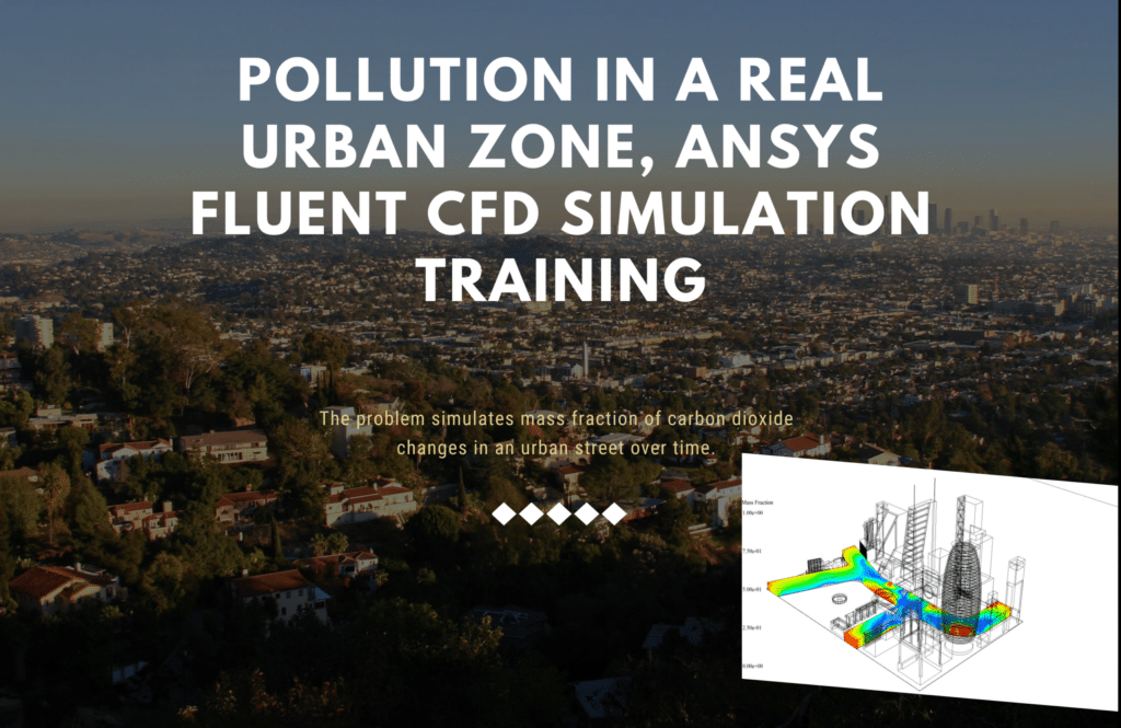
The ANSYS Fluent software is used to model the problem, which models how changes in the mass fraction of carbon dioxide might occur on an urban roadway. To replicate this model, it is necessary to consider a height area of 0.1 meters as a source of carbon dioxide pollution on the street from the urban domain. The primary objective of this simulation is to study the impact that free airflow has on the total amount of CO2 produced by automobile emissions. As a result, a source of mass production on a city street can be considered the definition of an integrated carbon-dioxide production region.
A free air flow with a velocity of 0.2 meters per second and a temperature of 300 degrees Kelvin enters the region surrounding an urban environment. The Species Transport model has been applied since CO2 and airflow are being studied; as a result, these gaseous species consist of air and CO2. The amount of carbon dioxide produced in the region defined by the street is four kilograms per cubic meter.
Urban Planning Industrial Companies
Several businesses focus on Urban Planning Engineering and other subjects that are closely related to it. Here are several examples:
AECOM: AECOM is a global engineering organization that offers various services, such as urban planning, transportation planning, and environmental planning. AECOM is located in over 100 countries across the world.
Jacobs: Jacobs is a global engineering firm that offers services in urban planning, transportation planning, and infrastructure design. Jacobs was founded in 1875.
Arup: Arup is a worldwide engineering and consulting company that offers services in urban planning, transportation planning, and building design.
Gensler: Gensler is an architecture and design firm that offers services in urban planning, architecture, and interior design.
Stantec: Stantec is a worldwide engineering and consulting company that offers services in urban, transportation, and environmental planning.
These businesses collaborate with national governments, local governments, private developers, and other stakeholders to plan, build, and manage urban landscapes that are environmentally friendly, economically sound, and suitable for human habitation. They build urban places by utilizing a multidisciplinary approach that considers not only the requirements of the current generation but also those of future generations. This strategy blends engineering and architecture with social and environmental concerns.
MR CFD Industrial Experience in the Urban Planning Field
Following is an example of an Urban Planning industrial project recently simulated and analyzed by MR CFD in cooperation with related companies.
Urban Heat Island (UHI) CFD Simulation on a Real Zone
- ANSYS Fluent was used for this study’s numerical Urban Heat Island (UHI) simulation.
- Looking into the Wind Comfort and Thermal Comfort and the Solar Radiation.
- Renovation Suggestion for Local Improvement.
The investigation of urban heat islands, often known as UHIs, is one of the academic community’s most widely pursued research topics. We make use of CFD analysis in our investigations into these topics.
On the North Island of New Zealand is where you’ll find the sprawling metropolis of Auckland—the urban area with the highest population in the country and the fifth largest city in Oceania overall.
To the east of Auckland is the Hauraki Gulf, to the southeast are the Hanau Ranges, to the southwest is Manuka Harbor, and to the west are the Waitakere Ranges. The slopes of the neighboring hills are blanketed in tropical forest, and there are 53 active volcanoes scattered across the terrain.
The climate of Auckland is classified as oceanic. The National Institute of Water and Atmospheric Research (NIWA) identifies the climate there as subtropical. This city has summers that are warm and muggy and winters that are mild but humid.
It has the highest average temperature of any major center in New Zealand. When compared to the average daily maximum temperature of 14.7 °C (58.5 °F) in July, the highest temperature in February is 23.7 °C (74.7 °F). On February 12, 2009, the highest temperature measured was 34.4 degrees Celsius (93.9 degrees Fahrenheit). However, the lowest temperature recorded was 3.9 degrees Celsius (25.0 degrees Fahrenheit).
Occasional instances of air pollution caused by emissions of fine particles can be found in Auckland. There are also sporadic instances of carbon monoxide levels that exceed the recommended thresholds. Even though coastal winds typically do a pretty good job of dispersing pollution in a relatively short time, haze can occasionally form, particularly on still winter days.
As a result of the location of the mean high-pressure band in the New Zealand sector of the Southern Hemisphere, nearly 30 degrees South, the winds that blow over the country are predominantly westerly.
However, daily, there is a large amount of fluctuation in how the pressure is distributed. Sometimes extremely powerful anticyclones will form in the southern part of the country, while depressions will form in the northern part. They are responsible for reversing the typical weather pattern, which results in an easterly flow. These stumbling blocks may linger for a while. They break in the more typical westerly winds connected with advancing meteorological systems toward the east.
This simulation aims to investigate ocean breezes’ influence on the traffic patterns on urban highways in the city of Auckland. As a result, the urban plan of the Auckland University of Technology (UHI) will serve as the focus of our investigation into this matter.
This study aims to investigate wind comfort conditions in the region and locate locations with wind speeds greater than 3.8 meters per second. To assess thermal comfort, the campus area should not have any locations with temperatures higher than 295 K.
MR CFD conducted numerous outsourced CFD simulation projects for industrial companies and research in Urban Planning Engineering applications. With several years of experience simulating various problems in various CFD fields using ANSYS Fluent software, the MR CFD is ready to offer extensive CFD Simulation, Training, and Consultation services.
You may find the Learning Products in the Urban Planning Engineering CFD simulation category in Training Shop. You can also benefit from the Urban Planning Engineering Training Package appropriate for Beginner, Intermediate, Advanced, and Expert users of ANSYS Fluent. Also, MR CFD is presenting the most comprehensive Urban Planning Engineering Training Course for all ANSYS Fluent users from Beginner to Experts.
Our services are not limited to the mentioned subjects. The MR CFD is ready to undertake different and challenging projects in the Urban Planning Engineering modeling field ordered by our customers. We even carry out CFD simulations for any abstract or concept Design you have to turn them into reality and even help you reach the best strategy for what you may have imagined. You can benefit from MR CFD expert Consultation for free and then Outsource your Industrial and Academic CFD project to be simulated and trained.
By outsourcing your project to MR CFD as a CFD simulation consultant, you will not only receive the related project’s resource files (Geometry, Mesh, Case & Data, …), but also you will be provided with an extensive tutorial video demonstrating how you can create the geometry, mesh, and define the needed settings(pre-processing, processing, and post-processing) in the ANSYS Fluent software. Additionally, post-technical support is available to clarify issues and ambiguities.


